Project Galileo (Autodesk Infrastructure Modeler)
Recently, the buzz about Autodesk’s Project Galileo (now graduated to Autodesk Infrastructure Modeler) has been growing and to be honest I was skeptical about the program. To me, it seemed just like another version of Google Earth. After using the software, I realize that I am very wrong. This program is a big deal and is actually worthy of much more buzz than it’s getting.
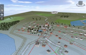
When I first loaded the software, I opened up the sample project “TinyTown” and was impressed. You’ll find right away that the graphical capabilities are top-notch for a CAD application. To me, the visuals are much flashier than Navisworks. The frame rate is very high, the textures are clear, and the water looks amazing. Note that the software is not designed to do the same thing as Navisworks (animation, clash detection, timeline simulation), however with more development, I could easily see this program able to do all of that.
Even though the visuals were impressive, it’s after loading some GIS data into Project Galileo that I realized that I was seeing the future of CAD software. At Project Galileo’s heart is a GIS application. It supports all of the typical FDO connection types that you are able to access inside of Map 3D. This is where the similarities end , there are some big difference between Map 3D and Project Galileo. That biggest one is that Project Galileo is very fast and 3D. If you’ve ever loaded a large amount of FDO data into Map 3D, you’ll find that it’s not as fast as working with native DWG entities. It’s a little early to say, but Project Galileo seems almost as fast as AutoCAD is. Note that Project Galileo does not seem to actively read from the database and loads everything into memory with preset attributes. Maybe that is why performance is much better than FDO. However, it’s hard to say for sure as Project Galileo is able to load quite a bit of information into memory.
Finally, what can you use Project Galileo for now? Currently, Project Galileo is a great tool for quick, real-time, visualization. For example, it would be a great application to use if you were bidding on a project and wanted a quick way to present your conceptual design intent using real world data from a variety of sources. It’s very simple to create proposed entities and clarify your design intent on top of the data that you import. It’s definitely not the software that you would use for creating your real design in, but who knows what Autodesk has in store for the core of Project Galileo in the future? My guess is that we’ll be seeing this technology implemented much more in the future.


